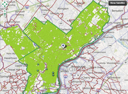
What is an urban forest? It’s the collection of trees that grow in an urban area. Urban tree canopy is important for both environmental and economic reasons, as it reduces stormwater runoff, improves air quality and raises property values. Philadelphia has an estimated 2.1 million trees, with canopy covering 15.7% of the city. Tree density amounts to roughly 25 trees per acre, which is comparable to tree density in other American cities such as San Francisco (22.5%) and New York (26.4%)
Recently, Philly Tree Map was launched to help build an inventory of the trees that make up the Philadelphia’s urban forest. This project is a result of a partnership between the City of Philadelphia, Delaware Valley Regional Planning Commission and the Pennsylvania Horticultural Society (PHS). Anyone can register for a free account to begin adding information to the database.
Philly Tree Map uses a wiki-based structure that allows registered users to add data pertaining to tree size and species. Reliable users gain reputation points that add up to enable access to higher-level editing features. If you’re not sure where to start, the FAQ section provides information on tree identification and measuring techniques. Also, this interview with Casey Combs of PHS offers insight to the development of project and its potential future uses.


