Northeast Philadelphia, Oxford Circle
Max Myers
Overview
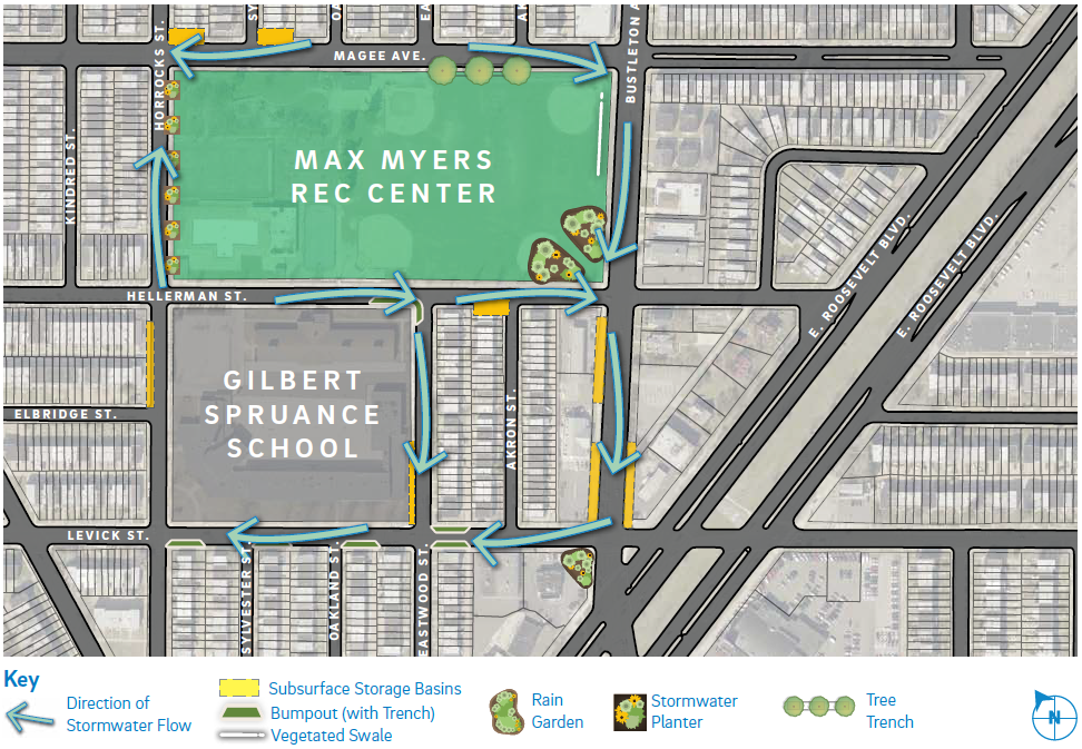
GSI project #50132 Max Myers is part of the overall Green Infrastructure Initiative, a program implemented by City of Philadelphia to improve the city’s stormwater management systems. The work was done in the Oxford Circle/Castor Gardens neighborhoods and added bumpouts, subsurface storage basins, swales, and rain gardens to the community.
Location
- Max Myers Recreation Center
Streets Affected
| Street | Segment | Type of Work |
|---|---|---|
| Magee Street | from Horrocks Street to Bustleton Avenue | |
| Hellerman Street | from Horrocks Street to Bustleton Avenue | |
| Horrocks Street | from Magee Street to Levick Street | |
| Levick Street | from Horrocks Street to Bustleton Avenue | |
| Eastwood Street | from Hellerman Street to Levick Street | |
| Bustleton Avenue | from Magee Street to E. Roosevelt Boulevard |
For worksite issues, contact:
- Imad Barrouh
Project Engineer
Imad.Barrouh@phila.gov
215-873-3779 - Nick DelCasale
Project Engineer
Nicholas.Delcasale@phila.gov
215-685-2120 - Jovan Como
Division Engineer
Jovan.Como@phila.gov
215-685-6357
For more information, contact:
- Amy Hopf
PWD Construction Liaison
water.construction@phila.gov